|
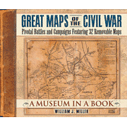
When Union Gen. George McClellan marched toward the Confederate capital of Richmond in 1862, he encountered the Warwick River 'where it wasn't supposed to be.' McClellan was following a map created by an esteemed topographer, but the map was wrong. 'The Cramp Map' that McClellan was using is one of the removable maps in Great Maps of the Civil War. So is the map Union Gen. James B. McPherson was carrying when he was killed on July 22, 1864, just east of Atlanta.'Commanders moving their armiesoften had to advance slowly, groping their way blindly,' says William Miller. 'They used what maps they could find, but most contained serious errors..Studies of Civil War maps usually focus on handsome, postbattle maps of battlefieldWhile these maps explain how a battle was fought, they do nothing to help us answer the questions about why a battle or campaign was conducted as it was.' The maps in Great Maps of the Civil War are the ones the commanders actually used or were likely to have been available to them. This book includes 32 removable maps.
|