|
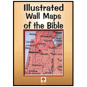
22 maps and plans (28' x 40') cover the whole Bible epoch. Specially designed as a teacher's aid, they can be used in conjunction with our Atlas of the Bible. Large and clearly presented; no need for special equipment or lighting. Ideal for use in school, Sunday School, Bible Class, Bible college or seminary. Suitable for adults or children. An economical and attractive way of bringing the Bible to life. Adds fresh meaning to familiar Bible stories and helps in teaching new material.
Maps Inlcude: The Ancient Near East: Culture and Commerce, The Second Millennium B.C., The Palace at Mari, The First Millennium B.C., The City of Babylon; The Old Testament: The Coming of the Israelites, The Exodus, The Kingdom of David and Solomon, Megiddo, a Chariot City, The Kingdoms of Judah and Israel, Jerusalem of the Old Testament; The Hellenistic World: Palestine in Graeco-Roman Times, Jerusalem of the Hasmoneans; The New Testament: Jesus in His Land, Jerusalem of the New Testament, The Journeys of the Apostles Antioch, Caesarea Maritima, The Spread of the Early Church, Paul's Missions ;Key Maps: Palestine in the Time of the Old Testament, Palestine in the Time of the New Testament
|