|
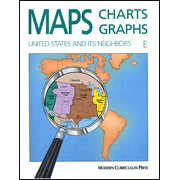
Use as a separate maps course or as a supplement to any social studies program. A wide variety of topics are covered with full color illustrations and engaging examples. Book E: United States and it's Neighbors, covers maps keys, directions, latitiude, longitude, scale, routs, landform and relief maps, highway maps, atlas, graphs, charts and diagrams, analyzing pictures, cartoon and cartoon interpretations, and more. Glossary, answer key, skills index and collection of full-color maps included. 76 pages, softcover. Non-reproducible pages.
|