|
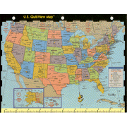
The World QuikView Map Measures 8 1/2' x 11'. It is a transparency with the countries of the world with time zones, longitude and latitude, national capitals, cities, international boundaries. On the other side is the map of the United States featuring the National Capital, State and Provincial Capital, Cities populations, International and StateBoundaries, and U.S. Time Zones. One inch is equal to approximate 2,400 miles. On the bottom it has centimeters from 1-26.
|